Detailed Material Objections (see update below)
See below for detailed material objections. Also see the pages ‘street-by-street’ for suggestions for objections relevant to nearby streets; ‘Hot off the press’ for the most recently published objections; and ‘No, we cannot support you’ on our News page, which highlights some of the policy breaking proposals that Ilke have put forward and are hoping that the council will overlook.
Anyone can make an objection, although it is limited to only one per household. We have summarised some of the key relevant objections, but there are many more that may be relevant to you that might not be on here, so feel free to add those to your objection letter.
A material objection is an objection, which questions whether a planning proposal has taken into account the impact on the local residents and environment and whether it conforms to local policies and standards. The council have to take into account valid objections made by the public when they are considering whether to allow the development. They may ask the developers to change the plans based on local objections.
DETAILED MATERIAL OBJECTIONS
Contents
***** Update November 2021 *****
1.Highway Safety
a) Immediate Access Vicinity
b) Wider Vicinity
c) Solution
d) Access Road – additional objections
2. Health
3. Children
4. Disability, Older Person’s and Walking Access
5. The Development
6. Layout and Density of Building
7. Flooding and Drainage
8. Local Infrastructure – Economic Impact and Sustainability
9. Eco-sustainability
10. Environment and Bio-diversity
11. Safety and Crime
12. Loss of Privacy – Prospect and Peck Way
13. Key Policy Quotes
Updated Proposal Objections (November 2021)
Ilke homes updated consultation documents do not meet key material objections already raised. Further objections are made below.
Construction Access and Abnormally Wide Loads through Higham Ferrers, Queensway, Manor Way and The Hedges to Prospect Avenue Site Access (Eight abnormal loads per week for 4 years!)
Access to the Development from Prospect Avenue & Development Design Issues
Whilst some tweaks have been made to the design of the development, previous material objections are still relevant and further objections are now being raised because of the detrimental impact to Prospect Avenue residents. There is No safe access to the site and the only logical and safe access is from John Clark Way. (Indeed the owner of the land between John Clark Way and the Development in their planning application documentation (NE_21_00518_OUT-PLANNING_STATEMENT-496278.pdf) states that they would work with Ilke Homes and the Co-OP to give access to the development from John Clark Way and that this would be an “Opportunity”. They say they could deliver an access road with capacity to serve the development and are eager to work with Ilke Homes.)
Further material objections to the application include;
- The car parking beat survey that was carried out on Prospect Avenue was invalid (not at night and on a weekend). They have not undertaken a valid parking beat survey when they updated their information even though they were informed that it was invalid.
- They say they have carried out a journey survey but this is also highly dubious and invalid. ‘The journey time survey emphasised how the proposed development is expected to not have a severe impact on the operation of Prospect Avenue.’ Yet they carried this out supposedly on a date that does not exist Wed 5Th of August. Do they mean Wed the 4th of August? It’s also, as pointed out previously by Highways not policy to carry road and parking surveys during term time or during the day. Yet they did this in the school holidays, when no one was doing the school run and people were on holiday. Are they being underhanded by picking the quietest time of the year and day to do this analysis especially when it has been pointed out already by Highways?
- They mention that they have undertaken a Stage 1 Road Safety Audit in respect of the site access from Prospect Avenue. This is a poor effort and has not at all addressed the many safety issues with the turn. There is not the required visibility, no safe turn for construction traffic that would not impact children using this route for school and fundamentals that are not being addressed. Ilke say that they have undertaken a Stage 1 Road Safety Audit in respect of the site access from Prospect Avenue, but this is a poor approach when this is only a basic level analysis. A Stage 2 Road Safety audit will immediately show the lack of viability because of the house at the end of the street. They themselves are planting a – Prunus x subhirtella ‘Autumnalis(tree) which grows to 450cm and is 16cm wide, according to them right in the visibility splay area which is limited at best with shrubs underneath so you cannot see round the corner when driving. This is a lack of judgement.
- The technical issues that have been raised by residents and Highways have not been resolved with regards to access from Prospect Avenue to the site. They admit this in their own justification paper ‘technical matters are being discussed with and liaised with Highways’ they just do not say they are resolved.
- There are still dangerous limitations to the site entrance, drives backing onto the junction, not the 43 meters required visibility, land not being controlled by highways, mature street trees being felled, loss of parking and access to 5+home’s drives, unsafe maneuvers having to be made to access and egress properties.
- They have completely ignored all the basic issues with the junction including the path crossing 71s drive and the lack of visibility.
- Site access design – They admit that there are issues with the driveways reversing and being within 25 meters of the give way lines and backing out onto the junction and say they can’t address this but they do not think this is a problem. It is a problem and Highways have already pointed this out.
- They say that visibility is generous at less that 30m when it should be 43 meters and even that visibility has risks with trees being planted by them and fences erected by people should they buy or sell no 71. Highways cannot control this land. They say the stage 1 RSA did not raise this as an issue when they know that this is not what a stage 1 RSA covers!
- Risk of collisions here are high especially because there is minimum visibility as well.
- There is no mention of a swept path analysis of how they will get the construction vehicles to site. What they have mentioned will negatively impact Higham Ferrers and Rushden residents. This proposed construction vehicle access route will put children, pedestrians and car owners at risk and does not seem logical or safe.
- School children on their way to The Ferrers school and traffic coming and going to the school will be put in danger as the abnormal loads are moved during the day. The 6-Meter-wide loads will overhang pedestrian paths or completely block the two way roads as they try to traverse up the middle.
- It is not possible to get wide loads of 6 meters plus through these streets there is just not enough space.
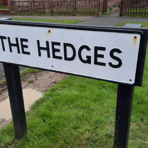
- Queensway, The Hedges and Manor Way are narrow roads and cars are parked throughout the streets. In most streets there is only a single track of 3 meters available due to parked cars, thus construction vehicles could not make the journey.
- Parking wide bans on these streets to facilitate the abnormally wide loads will mean people from these roads parking in Prospect Avenue. There are few free spaces as it is and this will cause much chaos for the four years duration of the build.
- Trees on Higham Main Street across from the Co-Op will be destroyed unless the abnormal loads travel down the middle of the road. Causing roads to be blocked. (This will happen along the main road from the roundabout to the site as well. (More chaos to add to ongoing roadworks at Chowns Mill roundabout.
- Car parking bans will be introduced for multiple streets for multiple years for this to go ahead which is illogical when they could gain access from John Clark Way.
- Taking abnormal loads through Higham High Street on such a frequent basis past parked cars and past Chicheley College will put these buildings at risk.
- Constant large trucks going by school children and through narrow streets with parked cars will be a significant safety issue.
- No engagement with residents has been had with regard to these construction access routes.
- There is no safe left turn to the site without blocking the road for long wheel-based.
- A right-hand turn lane for north bound traffic on Higham Rd into Prospect Avenue will require road widening that would mean the loss of very old and established street trees that give Rushden and Higham Ferrers real character and a welcoming feel. A biodiversity loss that would be very sad for the area. The trees at the top of Higham Hill are now suggested as being removed to allow road widening.
- New bus stop and road widening will likely mean a significant impact to Houses on Higham Rd. Impact of new bus stop to No 112, 114, 116, 118, 120. Especially on the brow of a hill and with driveways coming out and the junction and turning traffic into Prospect Avenue. Impact to No 105, 107, 109.
- Ilke admit they are losing biodiversity on the development site itself but have no plans to address this. Just provide a payoff. Just Section 106 for everything. They don’t want to address any issues. Just impact our neighborhoods and pay some other area for green space and biodiversity. Can we let this happen when the air pollution is in this area? How will they arrange for the clean air to be transported back here? Just ticking boxes here! No care and attention for the people of Rushden and Higham Ferrers.
- It would mean street furniture would have to be moved across from the shop on Higham Hill.
- This turn is not what Highways would advocate on such a busy road and cars exiting from Prospect Avenue would be taking significant risks for a right turn as they would not easily see cars coming behind the queuing cars.
- Ilke say that they have undertaken a Stage 1 Road Safety Audit in respect of the site access from Prospect Avenue and at the junctions, but this is a poor approach when this is only a basic level analysis.
- No new refuge point has been suggested to allow people to cross this proposed wide expanse of road with an extra turning lane.
- No mention has been made of the loss of parking that would impact current residents as a result of road widening.
- The proposal also fails to mention the brow of the hill which would make any bus stop moves very dangerous for pedestrians and cars. Cars overtaking a bus on the brow of the hill would not be able to see oncoming traffic.
- A bus stop move, which is likely to be required will mean greater walks for any people from the new development. Moving bus stops further away from those in need from the development and out with recommended walking distance. The maximum distance from a bus stop is meant to be 450m but this would be 600m+.
- No analysis has been undertaken and no engagement with people on Higham Road has been undertaken for these changes.
- The road widening proposed has already flagged up issues and is against the transport plan. Significant costs are proposed to widen road already crammed with traffic. (Access could be from John Clark Way, so not impact to this extent.)
- They still do not meet minimum green space requirements and point this out in their own documentation.
- They say that there are no access rights to the site and previous access has been unlawful. Yet footpaths have been present on this site for 50 years.
- They admit they are losing biodiversity but have no plans to address this. Just provide a payoff. Just Section 106 for everything. They don’t want to address any issues. Just impact our neighborhoods and pay some other area for green space and biodiversity. Can we let this happen when the air pollution is in this area? How will they arrange for the clean air to be transported back here? Just ticking boxes here! No care and attention for the people of Rushden.
- They mention people are concerned about HGVs but not AILs or abnormal wide loads. Again, they brush the issue under the table. Construction traffic ‘they are nevertheless willing to agree to route construction traffic from The Hedges to the north, off the A5028 via Queensway and Manor Way. These roads are generally of a greater width, with fewer parked cars and is devoid of street trees.’ They have not mentioned all the trees in Higham Road that would not be able to withstand the wide loads, or are they planning to stop all traffic so they can go down the middle of Higham Road through the town centre during the day. Then they would travel down Queensway where there are many children going to school and try and make two dangerous turns through Manor Way to The Hedges. The road is even narrower than Prospect Avenue with parking having to be up on the pavement. There is no way to get these vehicles down here unless there is parking bans for 4 years. Why should residents have their lives impacted? They also fail to mention the car that they said should park here from the displaced cars on Prospect Avenue as a result of the new junction. Chaos and a likely accident will be likely. Yet again they have not provided swept path analysis for these abnormal loads. This will be during the day when people are walking to and from school.
- Flooding and drainage documentation has been updated they say….and it’s just like they say you should be fine now. They have not changed their designs enough though.
- They have many excuses for not connecting to the Greenway and the railway bridge. Really a construction company and they could not provide a path for access? You will be able to see the Greenway but not walk on it. You can take up to ½ mile extra journey from the new development if you want access. What about the people who already use this access?
- Housing – they blatantly ignore the need for older peoples 1 bed housed saying that anyone who is old will have a live-in carer and need 2 beds! There is no evidence of them changing their plans to accommodate local and policy needs. They have only included
- Concerns for the lack of older people usable space and housing only 4 – 1 bed with access at ground level. Then some upstairs accommodation on offer so older people have to try and get up the stairs.
- The older peoples accommodation is very poorly thought through and stuck at the bottom of the site and furthest away from the bus stops. Also it is put in the area most likely to be flooded. There is little room for ramps to be proposed at the accommodation and pathways are still scare on some streets.
- Strangely the accommodation they have geared for disabled people who use wheelchairs is on the first floor upstairs. There is no lift and many disabled people can not transfer to stair lifts easily. Why would they consider this?
- Layout had a vast number of comments, yet they have not changed much of the plan to increase safety be removing alleyways behind houses.
- They have amended bedspaces on the site by removing 4 bed houses and changing them to 3 bed houses. This is not enough to reduce the density on the site. They still do not have enough green space or meet housing policy.
- Parking – Even though they know there is an over reliance on tandem parking they have still kept it. They have reduced numbers of parking but that was not the issue it was tandem parking and not providing enough parking so people did not need to park on the road.
- Planning Obligations
- They are casting doubt on wither they should pay for educational levies. They do not appear to take into account that there are no free spaces in the schools closest to here. eg Denfield Park Primary School, they also appear very reticent to make any contribution to educational fees. It’s again we will talk but not agree anything!
- Public Open Space – In accordance with the standards set out within Policy EN10, a scheme of 133 dwellings would be required to provided 1,850 sqm of amenity green space on site (excluding attenuation features). The Applicant has revised the scheme to increase the level of public open space on site from 750sqm to 1,417sqm. Again not meeting even basic levels of public open space requirements. Again they just want to talk about contributing section 106 to other green space areas. Just not where it is needed on the development. They keep saying they are constrained by the numbers on the development even though they have been advised that a lower no say 125 houses would be acceptable form housing and planning with a good site layout.
- Conclusion – they say that there plans are now technically sound but…..that is so far from the case as they say they will contribute section 106 – they are just ludicrous, not logical, unsafe an against planning policy and so unsympathetic to the area. They have not even tried to deal with key concerns! Privacy, safety …..
- They align 2.5 story houses back to back with PA to ensure there is no privacy and show no regard to living space windows facing each other. They have no deigns to show houses in context with Prospect Avenue or Peck Way.
- Site Plan proposed heights – why are so many of the tall dwellings (2 and a half story) behind prospect Avenue to look directly into people’s bedrooms and living areas.
Original Proposal Objection (April 2021)
1) Highway Safety
1a. Immediate Access Vicinity
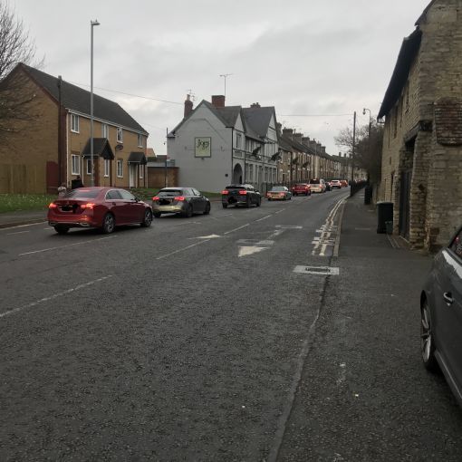
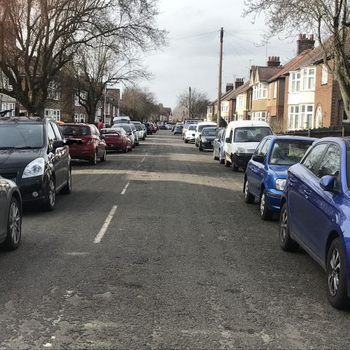
- The Avenue is a narrow road built in the 1920s and with most houses having two or more cars, residents parking makes it single track. Huge construction vehicles, 5m wide, bearing house units will be unable to navigate this.
- The street has only 3m available for passing due to parked cars in some places.
- Telephone poles are located on the pavement at regular intervals directly against the road.
- Trees are located on the pavement at regular intervals directly against the road. Any attempt to pass by a wide load will destroy them. (See Arboricultural impact assessment of the use of Prospect Avenue by Alchemy Tree Surgery.)
- The current gap between the overhanging canopies of the trees is barely 2 metres in places and any heavy pruning would not be possible without impacting their lifespan significantly due to their type. (prunus pissardii nigra – purple leaved plum)
- Vehicles will be 13m long, so could not avoid trees by switching from one side of the road to the other.
- No swept path analysis has taken place to see if the construction vehicles can access the site.
- Refuse vehicles will have difficulty getting around the proposed development and it has been shown that they will cross over footpaths. The Highways authority say that this will not be acceptable.
- The Construction Environmental Management Plan (CEMP), provides standard information typically required for a CEMP. It also clarifies that there will be some larger “Abnormal” loads (AIL) for delivery of the housing modules. However though the CEMP covers typical issues, it does not cover specific management information. Of specific concern:
- How will an AIL access along Prospect Avenue, between parked vehicles including the turn into the site.
- How specifically will be the PROW be protected, other than ‘suitable fencing’ whilst maintaining a suitable and safe pedestrian route
- Whilst CEMPs are usually the subject of a condition these points (particularly the first point) are fundamental to this specific scheme because of the particular size of the housing modules and these points MUST be adequately answered before planning permission can be granted.
- Access should be from John Clark as all previous planning policies have stated. This is what residents have understood and voted for when they affirmed the Neighbourhood Plan (2018) and specifically Policy H3 which simply indicates that “appropriate” vehicle and pedestrian access will need to be provided for.
- There is no access from Prospect Avenue and it is most definitely not “appropriate”. It is not proper removing a garage and squeezing a road around a sharp bend, from a well-loved community street.
- The proposed access is from the corner of Prospect Avenue/The Hedges. This is not safe and against Highway policy. This will create a high-risk area as it will triple traffic, increase risks to pedestrians and vehicles and create congestion in the immediate vicinity and in surrounding roads.
- The proposed junction is not safe and it is against Highway’s guidance.
- There would be multiple driveways reversing out onto the junction at odd angles.
- The minimum distance from the centre line of a junction to the nearest driveway should be a minimum distance of 25 meters. Here there are 6 properties within this distance. 5 of the properties (60, 62, 69,67,and 65 Prospect Ave) are within 10 meters. 4 of the properties would reverse straight out onto the junction itself.
- The minimum distance from the give way line of a junction to the nearest driveway should be 10 meters. There are 4 properties backing straight out onto the junction itself and thus below this required 10metes.
- The proposed junction is unsafe and against Highways guidance because there is not the required visibility. Visibility of 2m*43m is required to meet guidelines for a 30mph road on both sides of the access. This junction can barely meet 30m of visibility and that is trying to go across a garden and front door of No71.
- Not the required visibility at the proposed Prospect Avenue Junction of 43 Meters. Northamptonshire Development Management Strategy – Policy DM9 -The visibility requirements must be adhered to in the design of all developments and must conform to Design Manual for Roads and Bridges, (DMRB) guidance, Manual for Streets and the Local Highway Authority Standing Advice (April 2013), whichever Northamptonshire County Council considers is most relevant.
- For safety reasons, drivers should be able to see any potential hazard in time to slow down or stop before reaching it. To ensure good sight lines at junctions, along roads and streets or private drives should be designed with suitable visibility splays.
- The properties No 60 and 62, cannot have a shared dropped kerb reaching out to the proposed new footpath because that would not meet Highways guidance which states that the maximum length allowed for dropped kerbing is 11 meters before tapered and full height kerb is required.
- This proposed 30m visibility is also against Highways guidance as it goes across private land and is not owned by Highways. The proposed 30m visibility splay is also against Highways guidance because the splay cannot be kept free of all obstacles to a height of 0.6 meters above footway level. (Given No 71’s front door and the fact that the owner might put up a fence or a plant pot on the step.)
- The access is not allowable because it is being proposed in line with a private drive. (Which serves 5 properties.) This is not a private drive and is seeking to serve 138 properties.)
- The junction will increase noise, light and air pollution directly outside of established homes.
- There is no visibility from the road coming from the new development of any cars or pedestrians leaving the house at the end of the street. Even if a lower fence was put in children would be in danger.
- It will create significant direct risks when entering and leaving the established driveways near the new junction in Prospect Avenue and also in other parts of the Avenue and The Hedges due to the increased traffic flow.
- The footpath beside the new road on one side butts up against shrubs and the embankment, making it unsafe to walk at night.
- 11 car parking spaces are being removed as a result of the new junction which will cause havoc in an already congested street where there are no free spaces. Each home has multiple cars.
- No alternate parking has been specified for any of the properties except No 71.
- This is an issue, as most houses have only one off-street space and this will adversely impact on the amenity of local residents .The Transport Assessment (TA) said 4 cars were observed parking in the area of the junction kerbline. Rule 24 of the Highway Code states DO NOT stop or park opposite or within 10 metres (32 feet) of a junction, except in an authorised parking space which would reduce the number of free spaces. The TA said that of these cars 2 replacement spaces are provided for number 71, and the other cars have the opportunity to park just to the north on The Hedges. This section of the Hedges is too narrow (5.0m) for safe on-street parking where there is “through” traffic and existing cars are seen to park on the deep grass verge and so the opportunity for displaced vehicles to park along the Hedges is overstated.
- Specifically 2 spaces are being removed from the house at the very end of Prospect Avenue in their own property (No62 -a 4 Bedroom house) Ilke Homes are proposing leaving with only one car space instead of the three they have now. This is not acceptable planning policy.
- Impact of the lost spaces will cause a ripple effect down the street and this will again be worsened with the additional 1300 car journeys going up and down the street per day. (138 houses *2.5 cars*2 return journeys = 1380) Without even mentioning the service and delivery vehicles. At peak times 3.3 cars per minute extra could be going down the street and Prospect Avenue is effectively a single track with parking on both sides. This will conflict with the school run people going to Higham Ferrers school the other way. This is going to be just as bad as Washbrook Road!
- The parking assessment also identified numerous opportunities (48% of kerb space) for vehicles to easily pass along Prospect Avenue, given gaps in front of driveways and other kerb space. This simple “mathematical” assessment does reflect the reality of the situation!
- This is an issue, as most houses have only one off-street space and will adversely impact on the amenity of local residents. The TA identified 4 were observed parking in the area of the junction kerbline. Rule 24 of the Highway Code states DO NOT stop or park opposite or within 10 metres (32 feet) of a junction, except in an authorised parking space which would reduce the number of free spaces. The TA said that of these cars 2 replacement spaces are provided for number 71, and the other cars have the opportunity to park just to the north on The Hedges. This section of the Hedges is too narrow (5.0m) for safe on-street parking where there is “through” traffic and existing cars are seen to park on the deep grass verge and so the opportunity for displaced vehicles to park along the Hedges is overstated.
- It damages the character of the street by removing 2 Trees.
- The parking survey is invalid as it was not carried out between 1am and 5am at a weekend. Rather at 6.30-8.30 on a week night when people are coming and going on shifts e.g. Doctors, Nurses, Food Workers even in lockdown.
- This development will mean more cars, less spaces available for passing and more cars having to reverse. This will be particularly dangerous at night when it’s dark. This is not ‘appropriate’ access.
- The pedestrian/cycle link to Shirley Road, should be 3m wide (not 2m as presently identified on the masterplan) to safely accommodate pedestrians and cyclists.
1b. Wider Vicinity
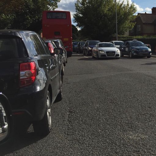
- There is already major congestion along Higham Road and Higham High Street. They are over-capacitous compared to 2031 aims and traffic on these streets need to be reduced, not increased. This development will force an extra proposed 330 cars on this route, increasing congestion and pollution in the already most congested and polluted area of East Northants.
- More cars and construction traffic doing a right hand turn into Prospect Avenue would increase congestion on the already very busy Higham Road.
- The Highways authority also has concerns about the increase in traffic that will be turning right off Higham Road (A5028). It is contrary to NCC policy for an intensification of usage of an existing access on a principle county road to be permitted. The Highway Authority actively resists all applications on the grounds of Highway safety, and the likely obstruction to traffic on a principle road whilst a vehicle is stationary on the carriageway waiting to turn into Prospect Avenue against oncoming traffic. The A5028 is a principle county road and carries a considerable volume of traffic throughout the day, and particularly during the two peak periods. A dedicated right turn lane would be required on Higham Road onto Prospect Avenue in order to mitigate the delay caused by vehicles waiting to turn right. For this to go ahead there would have to be a significant widening of Higham Road which in turn would mean loosing trees from the tree lined street, narrow footpaths, cause mayhem, need bus stops relocated, be a danger because of the brow of the hill and may not even be possible here.
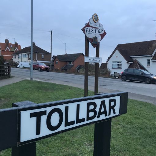
- The junctions of Higham Road with both Prospect Avenue and Tollbar, are both already hazardous and there have been several accidents at both junctions in recent years.
- This access will impact on Higham Road and adjoining streets, which already get very congested especially at peak times.
- Ilke Homes propose that construction may take four years, using lorries to transport quarter sections of pre-fab building along these roads. The construction vehicles will cause increased congestion and there will likely be issues with the extra wide loads.
- Rushden Transport Study 2014 highlighted congestion at Washbrook Road and Higham Road junction and recommended that this is not added to in any future development.
- Rushden Development Strategy – P141 (East Northamptonshire District Local Plan 1996), and the Rushden Transport Study on congestion state the need for schemes that will (A) take pressure away from the town centre and provide the opportunity for traffic management measures and environmental improvements to be introduced.” (4.19): (B) “5.1 Following the review of baseline and predicted traffic and travel conditions, the following priorities for the study have been identified;5.2 Signal junction of Washbrook Road with Higham Road… forecast as congested (6.37)”
- Traffic queues already often extend from the top of Higham Road to Asda impacting on the operation of the town centre road network.
- Access should be via John Clark Way as per Rushden Development Strategy, when this land was agreed for proposed development. Having construction traffic in the town for years and so many extra cars on a congested route would then be avoided.
- Traffic impact to the junction with Washbrook road will be severe and there is already severe congestion there at certain times of the day, such as school run times and commuter times.
- There would be increased congestion, increased pollution and increased safety risks as number of residential cars, delivery vehicles and trades people increase.
- Significant impact on the junction of Queensway and Higham Road. Pedestrian traffic crossing lights at the Co-operative shop area likely to be impacted.
- Likely impact on the Higham Ferrers town centre at the lights as traffic volumes increase from the new development.
- On a minor development as detailed on the developers document for Northamptonshire County Council, no dweling should be 300m from a bus stop. It is 375m minimum and 601m distance to the nearest bus stops on Higham Road and at Asda.
1c. Solution
- ·It is recommended that there is no further development that might increase congestion at Washbrook/ Higham Road junction (Rushden Traffic Survey, 2014).
- All prior documentation regarding access to any proposed development for this site has specified access from the by pass link road (now John Clark Way) see East Northamptonshire District Local Plan 1996 – Rushden Strategy Statement Policy RU3 (page 140); Three Towns Plan(ENC) , 2006, page 44, below.
- Access via John Clark Way would reduce impact on town congestion, local residents and ensure that an access road is safe and wide enough for wide-loads, with sufficient space for footpaths and uninterrupted visibility.
- Developers can make provision for safe crossing of the railway and Greenway, which have been placed here in spite of these prior plans. This has been done in developments in Higham Ferrers.
- The railway has been subject to a prohibition order since 2019 and is unlikely to run again for several years, thus building work would not affect it running.
1d. Access Road– additional material objections
- The long road coming from the development to Prospect Avenue would encourage cars to speed up and no traffic calming measures have been proposed to deal with the lack of visibility at the corner.
- Roads not-overlooked like this can contribute to crime and there is already a drug trafficking and use problem at this end of the street, with numerous reports to police and this being cited by Innes (Co-op solicitors) as a reason for shutting the footpath from Prospect Ave to Shirley Road.
2) Health
- Removes access routes and does not include access to schools, town, east-to-west flow across town. This increases reliance on cars, affecting air quality, levels of obesity and diabetes, strokes and car accidents, especially for children
- Narrow or no footpaths, dense housing, lack of outdoor space are against local planning policies and increase the risk of transmission of contagious diseases, including covid.
- The same factors negatively impact upon mental health.
3) Children
- Bringing more traffic around Higham Road increases congestion and air pollution. Already the worst area in East Northants for this and flagged up by the Rushden Traffic Survey (2014), this should be avoided.
- Prospect Avenue and The Hedges are used by many children accessing the nearby schools. Increasing traffic, reducing access to the Greenway and creating blind corners increase risk to this population.
- The site development is not child friendly. There are no pathways and multiple car filled cul de sacs with no footpaths. Dangerous cycling conditions. Goes against policy Rushden Neighbourhood Plan- Policy EN2 – Landscaping in Development.
- There are no play spaces on site. The Local Plan requires that in housing developments of 15 or more dwellings, developers must provide children’s play areas. There should be for the size of this development a LAP (pre-school play area) and a LEAP (age 4-8 play area), within 60m respectively and 100m of vicinity. Ilke state they have provided this, but they haven’t. There is nothing provided. (Rushden Neighbourhood Plan – Policy CL2; Council’s Open Space Supplementary Planning Document – Recreational Open Space Design Guide 1999.)
- With 138 houses being built, there is the requirement to have 7776 square meters (0.78 hectares) of outside recreational open space (864 square meters of open space per 15 dwellings) (Rushden Neighbourhood Plan – Policy CL2; Council’s Open Space Supplementary Planning Document – Recreational Open Space Design Guide 1999.) The space that is provided is far below this requirement.
- Developers must contribute towards upkeep of St James Park via section 106 for older children to use. Rushden Neighbourhood Plan – Policy CL2; East Northamptonshire Council’s Open Space Supplementary Planning Document
-
4) Disability, Older Person’s and Walking Access
- The definition of ‘older people’ is taken from the glossary of the NPPF: “People over retirement age, including the active, newly retired through to the very frail and elderly, whose housing needs can encompass accessible, adaptable general needs housing for those looking to downsize from family housing and the full range of retirement and specialist housing for those with care support needs”.
- Inclusive Mobility (2002) advises that ideally the width of the footway should be 2000mm to facilitate two people in wheelchairs to pass each other comfortably. Where this width is not possible, a clear width of 1500mm should be provided, with an absolute clear minimum width of 1000mm in exceptional cases.
- Elderly Access – the Rushden Neighbourhood Plan. Section 3.14. – “highlights the growth in older (65+ age group) households as the most pressing housing need facing North Northamptonshire”, yet there are inappropriate paths to support older and impaired people’s housing. There are no footpaths on many areas of plans.,
- Not disabled friendly. No pathways and multiple car filled cul-de-sacs with no footpaths. Dangerous cycling conditions. Goes against policy Rushden Neighbourhood Plan- Policy EN2 – Landscaping in Development.
- Disabled persons’ access not considered and poor footpath planning. No wide foot paths in some cul-de-sacs.
- No disabled parking identified with wide parking bays to facilitate wheelchair users.
- No navigable paths for people with wheelchairs or older people with walking sticks.
- No local hub areas with seating to promote community cohesion.
- Limited visibility of the road bend could impact people with hearing loss who may miss the cars.
- Older people residences not near the development entrance for ambulance visits and emergencies.
- No public open space considerations for older people with walking conditions and no access to green space with no internal footpaths noted around the public open space or the balancing pool.
5) The Development
- 100% social housing does not have a mix of tenures. NORTH NORTHAMPTONSHIREJOINT CORE STRATEGY 2011–2031 SECTION A: CORE POLICIESPOLICY 8 – NORTH NORTHAMPTONSHIRE PLACE SHAPING PRINCIPLES – states that plan should “Ensure adaptable, diverse and flexible places by: I. Creating varied and distinctive neighbourhoods which provide for local needs through a mix of uses, unit sizes and tenures”
- Development of Cul-de-sacs and enclosed area is against North Northamptonshire Core Strategy – NORTH NORTHAMPTONSHI RE: JOINT CORE STRATEGY 2011-2031 – Policy 2.49 states “The need to raise the quality of development and ensure that it connects to the existing settlement and contributes to making it more sustainable. This is a particular challenge where ring roads and modern cul-de-sac developments create barriers”
- Layout is single road and should be a loop, so that larger vehicles, including emergency vehicles and bin lorries can negotiate the roads.
6) Layout and density of building
The new Development Environment and Design does not fit into surrounding the developments of traditional brick built houses, footpaths, green areas and trees.
- Site layout, path structures and building types goes against design of adjacent streets.
- Tight and compact housing with very small dimensions.
- Few paths, nature area or trees in gardens.
- Alleyways behind fences backing on to established properties.
- The Rushden Neighbourhood Plan “Made” (adopted) June 2018 seeks to ensure new development “reinforces and complements the existing character of the settlement; rather than dissolves its heritage and history”.
- The Rushden Development Plan EN1 states “it should respect the prevailing density, pattern of development and materials used in the existing neighbouring properties and those in the vicinity of the application”
- The Rushden Development plan 3.20 states that ‘It is important to create places that are sympathetic to the local character of the surrounding environment, achieved through the use of locally sourced materials where appropriate, which reflect the distinctive characteristics of the settlements in North Northamptonshire, and the creation of streetscapes that are visually sympathetic to the historic environment’. This development lacks sympathy, empathy and any reflection of the local environments.
- Rushden Neighbourhood plan – Policy EN1 – Make provision for an appropriate amount of outdoor amenity space – yet there are no play facilities on the plan.
8) Flooding & Drainage
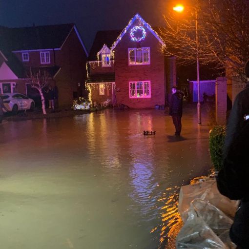
- On 23rdDecember 2020 homes in Peck Way flooded, for the first time since the development was built (circa 2002). This followed massive clearance, leaving the clay soil lacking infiltration. On checking the flood register there is a danger of surface water flooding on the site coming down from the hill. The current plans do not indicate that they have taken this into account or the environmental landscape with the location of the drainage areas. The design of the development means that properties in Peck Way will remain ‘at risk’.
- Ilke homes, in their ‘Flood Risk Assessment’ and drawings state that they will use a crate system – under the only piece of open ground that they have. This space will not be adopted by Anglian Water and will require ongoing permanent maintenance or it will lead to flooding. Roads and drives will be mostly tarmac and result in fast water flow to the bottom of the site. Ilke say they will raise houses by 300mm to stop internal flooding, but they do not account for the increased risk to houses on Peck Way and Shirley Road?
- In proportion to housing, there is a huge amount of tarmacked or surface area, in area already at major risk of surface flooding. The site does not consider the current flood maps or existing flooding issues. Goes against policy Rushden Neighbourhood Plan- Policy EN2 – Landscaping in Development.
- Local Northamptonshire flood guidance states this area as high level of flood risk 1 in 30 years. Northamptonshire County Council LOCAL STANDARDS AND GUIDANCEFOR SURFACE WATERDRAINAGE IN NORTHAMPTONSHIRE.
Thus, according to this guidance document, design should include, but in this design does not seem to include:
- Swales (shallow grass channels with wide, flat bottoms and gentle side slopes. They allow water to flow from one place to another and let it soak into the ground in the process. They can also store water, but may need lining if there are contaminants).
- Filter strips (sloping grass next to a hard surface can filter out pollutants as water flows over the surface toward the next Suds feature).
- Permeable Pavement (Hard surfaces can be designed to allow water to pass through, rather than run off, the surface. This allows the water to be naturally treated to remove pollutants and stored in the stone beneath the paving).
- Balancing Pond volume: The scale of this only takes in current development. What calculations have been made to cover Greenway and run off from Prospect Avenue? May not be suitable for steep sites, due to requirement for high embankments – Perceived health & safety risks may result in fencing and isolation of the pond. – Does not work well with high density sites like this one.
- Source Control Run off: Source is known to be top left of site, but no provision for water collection there to slow the flow or treat pollution.
- Site Slope: uncontrolled discharge increases run-off velocity.
8) Local Infrastructure – Economic Impact and Sustainability
- No ability for close schools to take in neighbourhood children. Denfield Park Primary oversubscribed and not likely to be enlarged.
- No space in nearby dentists for NHS patients.
- No ability for local Doctor Surgery’s to take on extra 300 patients (138 *2.4 = 331.2)
9) Eco-Sustainability
- No cycle parking.
- No cycle paths.
- No electric car charging points or layout to enable this (Rushden Neighbourhood Plan) The Neighbourhood Plan is conscious of changes in how transport is fuelled, with alternative fuels such as electricity playing a greater role as this could lead to lower levels of pollution. To encourage greater use of electric and plug-in hybrid electric vehicles within Rushden, this Plan wishes to support the installation of electric car charging infrastructure.
10) Environment and Biodiversity
- The new development does not tie into the network of green spaces and routes to allow movement across Rushden and Higham Ferrers, i.e. No tie in to Greenway which is just beside development. Designed like a walled in place, not integrated into local community. NORTH NORTHAMPTONSHIREJOINT CORE STRATEGY 2011–2031 SECTION A: CORE POLICIESPOLICY 8 – NORTH NORTHAMPTONSHIRE PLACE SHAPING PRINCIPLES states that new development should “Improve or create open green spaces which tie into the wider network of public green spaces and routes to allow for movement across the settlement through its green infrastructure”.
- The plan goes against recommendations in the Three Towns plan, which states that “Additionally, it will be important for development of the site to enhance the green framework in the area by providing connections between the railway line (a County Wildlife site and proposed Greenway) and the wooded area north of Crane Close / Peck Way……Development will be expected to link green routes in the area”
- There is no link corridor from the pocket park at Peck Way to the Pocket Park/Greenway. There was meant to be a link between these pocket parks, consisting of a 20 meter buffer zone (wildlife corridor) behind Prospect Avenue. The proposed road cuts through the green link from the pocket park to the Greenway (Policy: Biodiversity SPD for Northamptonshire).
- The Biodiversity Supplementary Planning Document (SPD) was endorsed by The Planning Policy committee in February 2016 after amendments to reflect consultation feedback. It is designed to be used by those considering and applying for planning permission in Northamptonshire. It explains how biodiversity shall be integrated into the development process to ensure that legislation and policy requirements are met and best practice standards are achieved. It offers a standardised approach which all applicants should follow. The SPD builds and expands on the main principles set out in the National Policy Planning Framework (NPPF) and relevant Local Plan policies. This SPD replaces the previously adopted 2010 Biodiversity SPD and all partner Local Authorities will be independently adopted the SPD.
Biodiversity features should be considered, including things like:•
- Species and their habitats (including feeding, resting and breeding areas): note this may include features like trees and buildings that could hold protected species (e.g. owls, bats)
- Statutory and non-statutory nature conservation sites
- UK and Local Biodiversity Action Plan habitats and species
- Habitats and Species of Principal Importance for England (under section 41 of the Natural Environment and Rural Communities Act 2006)
- Features which provide links/corridors or stepping stones from one habitat to another
Ilke state in their application that they can not sustain the biodiversity – this is even though they didn’t take a baseline until after they had removed the trees and displaced the wildlife on site. Thus, their proposal will result in:
- The Biodiversity Supplementary Planning Document (SPD) for Northamptonshire not being adhered to.
- A net loss in Biodiversity
- Habitats destroyed when site cleared. Loss of trees, ground cover and green space.
- Picture and anecdotal evidence of lost newts, bats, lizards highlighted by local residents, suggests loss of species, including protected species.
- No proposed Hedgehog highway, minimal replacement of habitat for bat population (a few bat boxes).
- Japanese Knotweed was noted on site and has not been addressed.
- Not enough public open space or natural habitats.
11) Safety and Crime
NORTH NORTHAMPTONSHIREJOINT CORE STRATEGY 2011–2031 SECTION A: CORE POLICIES: POLICY 8 – NORTH NORTHAMPTONSHIRE PLACE SHAPING PRINCIPLES identifies the need to:
- Seek to design out antisocial behaviour and crime and reduce the fear of crime through the creation of safe environments that benefit from natural surveillance, defensible spaces and other security measures having regard to the principles of the “Secured by Design”;
- Make safe and pleasant streets and spaces by prioritising the needs of pedestrians, cyclists and public transport users and resisting developments that would prejudice highway safety
This development does not acknowledge these issues.
- 100% Social housing – Dense housing with 100% social housing estates experience 2- 10 times the national average of crimes, including burglaries, assaults and anti-social behaviour. This is sustained by crowded closed physical environments, and lack of home-ownership, bringing misery and trauma to individuals, marginalisation of communities and ghettoing of estates.
- Major safety issues for pedestrians, housing on blind corners, increased traffic and congestion, noise, road surface wear and tear.
- Increases cars on access road and adjoining A6 – already an identified congestion route.
- No cycle paths or green charging points.
- New development access road to Prospect Avenue is not overlooked and at night would be unsafe for older people, and people on their own, especially given known (reported recurrent) drug dealing in this vicinity at present.
- The increase in traffic on Prospect Avenue in conjunction with more tightly packed car parking will make reversing cars and children crossing the street more prone to accidents.
- The increase in pollution from the extra cars will have a detrimental health effect as Rushden Town centre, which has the worst air quality in East Northamptonshire.
- Narrow alleyways proposed behind established housing provide areas that are hidden and prime for anti-social behaviours, such as burglary, graffiti and drug taking.
12) Loss of Privacy – Prospect and Peck Way
- Back to back properties and alleyways behind fences with little gardens resulting in noise and light pollution and overlooking into peoples houses that are already established. Directly against policy – NORTH NORTHAMPTONSHIREJOINT CORE STRATEGY 2011–2031 SECTION A: CORE POLICIESPOLICY 8 – NORTH NORTHAMPTONSHIRE PLACE SHAPING PRINCIPLES. “Ensure quality of life and safer and healthier communities by Protecting amenity by not resulting in an unacceptable impact on the amenities of future occupiers, neighbouring properties or the wider area, by reason of noise, vibration, smell, light or other pollution, loss of light or overlooking”
- Loss of privacy as established houses will be overlooked, with existing plans lining houses up back to back with key windows like bedrooms facing each other and the likelihood of Prospect Avenue which is at a higher level looking straight into rooms.
13) Key Policy Quotes
“RU3 A – East Northamptonshire District Local Plan 1996 Rushden Strategy Statement”
“Development will not be able to proceed until the proposed link road from the A6 bypass to the town centre has been provided. Access to the site will need to be from the new link road, or from an extension to it,”
Three Towns Plan Section 5.9
“5.9 The preferred option is to allocate the Shirley Road site for around 100 dwellings and open space in the first half of the Plan period, with vehicular access to be gained from John Clark Way. Development will be expected to link open spaces and green routes in the area.”
Three Towns Plan. Section 5.7.
” The site is surrounded by existing and proposed residential uses and is predominantly classified as greenfield, although a small central portion of the site was previously a coal storage depot (brownfield). Vehicular access to the site is somewhat limited, with the local Highway Authority expressing concern about the use of Shirley Road and the impact of additional traffic on its junction with Higham Road. Access can, however, be gained from John Clark Way, although the crossing of the dismantled railway line needs to ensure that its future use as a walking and cycling route and its historical transport value are not compromised. Additionally, it will be important for development of the site to enhance the green framework in the area by providing connections between the railway line (a County Wildlife site and proposed Greenway) and the wooded area north of Crane Close / Peck Way.
East Northamptonshire District Local Plan 1996 Rushden Strategy Statement
- RU3 -A ) Prospect Avenue – This site is considered appropriate for general industrial and commercial activities of the type included in Use Classes B1, B2 and B8. Development will not be able to proceed until the proposed link road from the A6 bypass to the town centre has been provided. Access to the site will need to be from the new link road, or from an extension to it, depending on final decisions regarding the design of the link road. The site is subject to some dereliction and a ground and soil condition survey will need to be carried out. In addition to on-site works, foul and surface water sewers will need to be constructed along the line of the town centre link road, to its junction with Rectory Road, This should be provided as part of a joint scheme, also serving the proposed commercial development to the west and to the north, referred to in the Strategy Statement for Higham Ferrers and residential proposals to the south. Improvements will be required to the pumping station and the sewage treatment works. Upgrading of the water supply system may be necessary and will need to be funded at the developer’s expense. A landscaped buffer of at least 20 metres width will need to be provided between the development and the existing residential properties to the west of the site. Before development of the site can commence, a detailed development brief will need to be prepared and agreed. This could be prepared in association with the development brief for site B below and other proposals detailed in the Strategy Statement for Higham Ferrers. A public right of way crosses the site and provision should be made for its retention or diversion.
- B) Shirley Road – The location of this site near to the town centre and adjacent to proposed new road links, means that it has potential for more general forms of commercial activity. The site is considered appropriate for industrial and commercial activities included in Use Classes B1, B2 and B8. Development will not be able to proceed until the proposed link road from the A6 bypass to the town centre has been Access to the site will need to be from the new link road or from an extension to it, depending on final decisions regarding the design of the link road. The site is subject to some dereliction and a ground and soil condition survey will need to be carried out. In addition to on-site works foul and surface water sewers will need to be provided along the line of the town centre link road to its junction with Rectory Road. This should be provided as part of a joint scheme also serving the commercial sites to the east and to the north referred to in the Strategy Statement for Higham Ferrers and residential land to the south. Improvements will be required to the pumping station and the sewage treatment works. Upgrading of the water supply system may be necessary and will need to be funded at the developer’s expense. A landscaped buffer of at least 20 metres width will need to be provided between the development and the existing residential properties to the north of the site. Before development of the site can commence a detailed development brief will need to be prepared and agreed. This could be prepared in association with the development brief for site A above and other proposals detailed in the Strategy Statement for Higham Ferrers.
Rushden Neighbourhood Plan “Made” (adopted) June 2018 1.1Rushden Neighbourhood Plan has been prepared under the provisions of the 1990 Town and Country Planning Act (as amended by the 2011 Localism Act) and the Neighbourhood Planning (General) Regulations 2012. It is intended to guide the future development of the town up to 2031, supporting strategic policies of the Local Plan